
Файл:City of London skyline from London City Hall - Oct 2008.jpg

Алдан карауның зурлыгы: 800 × 420 нокта. Башка ачыклык: 320 × 168 нокта | 640 × 336 нокта | 1024 × 537 нокта | 1280 × 671 нокта | 2560 × 1343 нокта | 8441 × 4427 нокта.
Төп файл (8441 × 4427 нокта, файл зурлыгы: 10,81 Мб, MIME төре: image/jpeg)
Тасвирлама
| Тасвир |
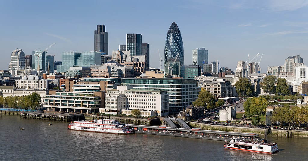
English: The City of London skyline as viewed toward the north-west from the top floor viewing platform of London City Hall on the southern side of the Thames. In the foreground: Dixie Queen and Millennium Time at Tower Millennium Pier. This is a 5 segment panoramic image taken by myself with a Canon 5D and 24-105mm f/4L IS lens. |
| Дата | |
| Чыганак | Үз эшем |
| Автор | Diliff |
| Рөхсәт (Бу файлны кабат куллану) |
Summary:In using this image or any subsequent derivatives of it, you are required to release the image under the same license. As such, any reproduction of this image, in any medium, must appear with a copy of, or full URL of the license.Attribution of this image to the author (DAVID ILIFF) is also required, preferably in a prominent location near the image.No other conditions may be added to, or removed from this license without the permission of the author and copyright holder.Suggested attribution: "Photo by DAVID ILIFF. License: CC BY-SA 3.0"Please review the full license requirements carefully before using this image. If you would like to clarify the terms of the license or negotiate less restrictive commercial licensing outside of the bounds of GFDL/CC-BY-SA, please contact me by email, or if you don't have a Wikipedia account you can either leave a message on my talk page with your contact details and your request, or you can contact me on Facebook. Please also send a 'friend request' to ensure that I am aware of your message. |
| Башка юрамалар |
  |
| Местоположение камеры | | Это и другие изображения по их местоположению на OpenStreetMap |
|---|
Лицензияләү
Я, владелец авторских прав на это произведение, добровольно публикую его на условиях следующих лицензий:
Әлеге файл Creative Commons Attribution-Share Alike 3.0 Unported лицензиясе буенча рөхсәт ителгән.
- Сез ирекле рәвештә:
- уртаклашырга – бу язмадан күчермә алырга, таратырга һәм тапшырырга
- юрамалар ясау – бу язманы үзгәртергә
- Түбәндәге шартларда:
- атрибуция – Сез тиешле бәя, лицензиягә сылтама бирергә һәм үзгәрешләр кертелгәнме-юкмы икәнен күрсәтергә тиешсез. Сез моны теләсә-нинди дөрес булган ысул белән эшли аласыз, әмма лицензиар сезне яки куллануыгызны хуплый дигән фикер калырга тиеш түгел.
- шул ук кагыйдәләр буенча таратыла – Әгәр сез бу әсәрне үзгәртәсез, әверелдерәсез яки аның нигезендә яңаны булдырасыз, башлангыч әсәрнең рөхсәтнамәсен яки башлангыч рөхсәтнамәгә туры килә торган рөхсәтнамәне кулланырга тиешсез.

|
Бу документтан күчермә алырга, аны таратырга һәм/яки үзгәртергә Ирекле программалар фонды тарафыннан бастырылган 1.2 һәм соңрак чыгарышлы GNU Free Documentation License шартлары буенча хакыгыз бар, әмма үзгәрмәс бүлекләрсез, алгы һәм арткы тышлыктагы текстсыз. Лицензиянең күчермәсе GNU Free Documentation License исемле бүлеккә кертелгән. |
Сез теләгән лицензияне сайлый аласыз.
Оценка
|
Это изображение было оценено c использованием руководства по качественным изображениям и признано качественным изображением.
|
| Аннотации | Это изображение аннотировано: Просмотреть аннотации на Викискладе |
Файл тарихы
Файлның нинди булганлыгын күрү өчен «дата/вакыт» дигәненә басыгыз.
| Дата/вакыт | Кече рәсем | Үлчәмнәре | Кулланучы | Искәрмә | |
|---|---|---|---|---|---|
| агымдагы | 24 июн 2012, 07:41 | | 8441 × 4427 (10,81 Мб) | Tim! | Reverted to version as of 12:54, 12 October 2008 |
| 12 окт 2008, 12:54 |  | 8441 × 4427 (10,81 Мб) | Diliff | {{Information |Description={{en|1=The City of London skyline as viewed toward the north-west from the top floor viewing platform of London City Hall on the southern side of the Thames. This is a 5 segment panoramic image taken by myself with a Canon 5D an |
Файлны куллану
Әлеге файл киләсе битне куллана:
Файлның гомуми кулланышы
Әлеге файл аста бирелгән викиларда куллана:
- af.wikipedia.org проектында куллану
- ar.wikipedia.org проектында куллану
- az.wikipedia.org проектында куллану
- az.wiktionary.org проектында куллану
- be-tarask.wikipedia.org проектында куллану
- be.wikipedia.org проектында куллану
- bg.wikipedia.org проектында куллану
- bs.wikipedia.org проектында куллану
- ca.wikipedia.org проектында куллану
- cy.wikipedia.org проектында куллану
- de.wikipedia.org проектында куллану
- en.wikipedia.org проектында куллану
- Tower Millennium Pier
- Wikipedia:WikiProject UK geography
- Wikipedia talk:WikiProject UK geography
- User:Diliff
- Portal:London/Pictures/Wikipedia featured pictures
- Wikipedia:Featured pictures/Places/Panorama
- Portal:United Kingdom/Featured picture
- Wikipedia:WikiProject UK geography/Announcements
- Wikipedia:Featured pictures thumbs/13
- Metropolis
- Wikipedia:Featured picture candidates/October-2008
- Wikipedia:Featured picture candidates/City of London skyline
- Wikipedia:Wikipedia Signpost/2008-11-08/Features and admins
- Wikipedia:Wikipedia Signpost/2008-11-08/SPV
- Wikipedia:Picture of the day/June 2009
- Template:POTD/2009-06-08
- User talk:Diliff/Archive6
- List of central business districts
- Wake Up to Money
- User:Quibik/Montage
- Portal:London/Featured picture
- Portal:London/Featured picture/12
- User talk:Sabrebd/Autoarchive 4
- Talk:United Kingdom/Archive 27
- User talk:Ottoniel B
- Portal:United Kingdom/Featured picture/47
- Talk:London/Archive 11
Бу файлның гомуми кулланышын карау.