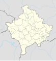
Файл:Kosovo adm location map.svg

Битнең эчтәлекләре башка телләрдә бирелми.
Wikipedia — ирекле энциклопедия проектыннан ([http://tt.wikipedia.org.ttcysuttlart1999.aylandirow.tmf.org.ru/wiki/Kosovo adm location map.svg latin yazuında])

Төп файл(SVG файлы, шартлы 1014 × 1109 нокта, файлның зурлыгы: 185 Кб)

Бу файл Викиҗыентык проектыннан һәм башка проектларда кулланылырга мөмкин. Файл турында тулырак мәгълүмат түбәндә күрсәтелгән.

Тасвирлама

Тасвир
Deutsch: Positionskarte des Kosovo
English: Location map of Kosovo

Equirectangular projection, vertical stretching 135 %
Border coordinates

43.3
19.8←↕→21.9
41.7
 Для справки This map is part of a series of location maps with unified standards: SVG as file format, standardised colours and name scheme. The boundaries on these maps always show the de facto situation and do not imply any endorsement or acceptance. In case of changes of the shown area the file is updated. The old version will be uploaded as a new file and thus is still available.
Дата
Чыганак

Собственная работа, используя:

  • United States National Imagery and Mapping Agency data
Автор NordNordWest
Башка юрамалар
SVG‑разработка
InfoField
 
Исходный код этого SVG-файла корректен.
 
Это map было создано с помощью Adobe Illustrator
Kartenwerkstatt
Эта карта была улучшена в немецкой Kartenwerkstatt. Вы можете также предложить другие карты для улучшения.

Лицензияләү

Usage of this file with:

explanatory notes: Legally binding is only the full legalcode. For a free usage I recommend to respect the following licence conditions:
1. Provide my name as given above: NordNordWest,
2. a copy of, or the URI for, the applicable license: https://creativecommons.org/licenses/by-sa/3.0/de/legalcode,
3. the title of the work,
4. in the case of an adaptation, a credit identifying the use of the work in the adaptation.
This license and the rights granted hereunder will terminate automatically upon any breach by you of the terms of this license. Any of the above conditions can be waived if you get permission from the copyright holder. If you have questions or wish differing conditions, please contact me through nnwest@t-online.de or my discussion page

w:ru:Creative Commons
атрибуция шул ук кагыйдәләр буенча таратыла
Этот файл доступен по лицензии Creative Commons Attribution-Share Alike 3.0 Германия.
Авторлыкны күрсәтү: Karte: NordNordWest, Lizenz: Creative Commons by-sa-3.0 de
Сез ирекле рәвештә:
  • уртаклашырга – бу язмадан күчермә алырга, таратырга һәм тапшырырга
  • юрамалар ясау – бу язманы үзгәртергә
Түбәндәге шартларда:
  • атрибуция – Сез тиешле бәя, лицензиягә сылтама бирергә һәм үзгәрешләр кертелгәнме-юкмы икәнен күрсәтергә тиешсез. Сез моны теләсә-нинди дөрес булган ысул белән эшли аласыз, әмма лицензиар сезне яки куллануыгызны хуплый дигән фикер калырга тиеш түгел.
  • шул ук кагыйдәләр буенча таратыла – Әгәр сез бу әсәрне үзгәртәсез, әверелдерәсез яки аның нигезендә яңаны булдырасыз, башлангыч әсәрнең рөхсәтнамәсен яки башлангыч рөхсәтнамәгә туры килә торган рөхсәтнамәне кулланырга тиешсез.

Краткие подписи

Добавьте однострочное описание того, что собой представляет этот файл

Элементы, изображённые на этом файле

тасвирланган феномен

Файл тарихы

Файлның нинди булганлыгын күрү өчен «дата/вакыт» дигәненә басыгыз.

Дата/вакытКече рәсемҮлчәмнәреКулланучыИскәрмә
агымдагы17 мар 2020, 18:2917 мар 2020, 18:29 юрамасы өчен кече рәсем1014 × 1109 (185 Кб)NordNordWestReverted to version as of 13:31, 16 March 2018 (UTC), not without a discussion
17 мар 2020, 12:1517 мар 2020, 12:15 юрамасы өчен кече рәсем512 × 560 (119 Кб)ZvuqnikiReverted to version as of 13:09, 16 March 2018 (UTC)
17 мар 2020, 12:1217 мар 2020, 12:12 юрамасы өчен кече рәсем1014 × 1109 (210 Кб)ZvuqnikiThis map reflects the current reality regarding the border of Kosovo. Serbia has no authority over Kosovo, and there are police and military forces that all Kosovo borders.
16 мар 2018, 13:3116 мар 2018, 13:31 юрамасы өчен кече рәсем1014 × 1109 (185 Кб)NordNordWestReverted to version as of 18:29, 12 January 2018 (UTC) Serbia still thinks that Kosovo is part of Serbia, so it stays with a dashed line
16 мар 2018, 13:0916 мар 2018, 13:09 юрамасы өчен кече рәсем512 × 560 (119 Кб)HakuliKosovo new map updatet. The dashlines are removed. The dashlines are used only when is shown a larger map.
12 гый 2018, 18:2912 гый 2018, 18:29 юрамасы өчен кече рәсем1014 × 1109 (185 Кб)NordNordWest== {{int:filedesc}} == {{Information |Description= {{de|1=Positionskarte des Kosovo}} {{en|1=Location map of Kosovo}} {{Location map series N |stretching=135 |top=43.3 |bottom=41.7 |left=19.8 |right=21.9 }} |Source={{Own using}} * United States Nationa...

Әлеге файл киләсе битне куллана:

Файлның гомуми кулланышы

Әлеге файл аста бирелгән викиларда куллана:

Бу файлның гомуми кулланышын карау.

Метабирелмәләр