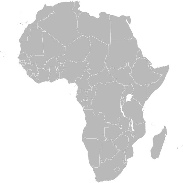
Файл:BlankMap-Africa.svg

600 × 600 нокта - SVG файлын беренчел карау размеры PNG. Башка ачыклык: 240 × 240 нокта | 480 × 480 нокта | 768 × 768 нокта | 1024 × 1024 нокта | 2048 × 2048 нокта | 1000 × 1000 нокта.
Төп файл (SVG файлы, шартлы 1000 × 1000 нокта, файлның зурлыгы: 184 Кб)
Файл тарихы
Файлның нинди булганлыгын күрү өчен «дата/вакыт» дигәненә басыгыз.
| Дата/вакыт | Кече рәсем | Үлчәмнәре | Кулланучы | Искәрмә | |
|---|---|---|---|---|---|
| агымдагы | 29 апр 2020, 06:01 |  | 1000 × 1000 (184 Кб) | Kaldari | Listing the actual European territories in the comments so that they aren't a mystery |
| 8 ноя 2011, 13:50 |  | 1000 × 1000 (184 Кб) | Htonl | South Sudan has been allocated ISO code SS; change class and id correspondingly | |
| 9 июл 2011, 21:38 |  | 1000 × 1000 (184 Кб) | Lokal Profil | Fixed code. Essentialy reverted and readded south sudan manually | |
| 9 июл 2011, 17:09 |  | 1000 × 1000 (185 Кб) | Seb az86556 | +South Sudan | |
| 18 июл 2010, 16:04 |  | 1000 × 1000 (185 Кб) | Stephen Morley | Fixed errors that made SVG invalid | |
| 22 сен 2009, 16:22 |  | 1000 × 1000 (185 Кб) | Lokal Profil | Reverted to version as of 00:54, 3 April 2008; the new map contains none of the iso code and css abilities of the original | |
| 22 сен 2009, 15:11 |  | 1000 × 1000 (352 Кб) | NuclearVacuum | minor change | |
| 22 сен 2009, 15:06 |  | 1000 × 1000 (352 Кб) | NuclearVacuum | Fixed map so it shows surrounding countries as well as making the code valid | |
| 3 апр 2008, 00:54 |  | 1000 × 1000 (185 Кб) | Lokal Profil | reunion, saint helena, madeira and canary islands (mayotte already in) added for completion | |
| 1 апр 2008, 00:21 |  | 1000 × 1000 (182 Кб) | Lokal Profil | Made circles smaller, and circular. They were the right size for the world map but to big for the Africa only map |
Файлны куллану
Бу файлны кулланган битләр юк.
Файлның гомуми кулланышы
Әлеге файл аста бирелгән викиларда куллана:
- af.wikipedia.org проектында куллану
- Vlag van Suid-Afrika
- Vlag van Senegal
- Vlag van Mauritanië
- Vlag van Guinee-Bissau
- Vlag van Mali
- Vlag van Niger
- Vlag van Eswatini
- Vlag van Algerië
- Vlag van Namibië
- Vlag van Angola
- Vlag van Botswana
- Vlag van Benin
- Vlag van Burkina Faso
- Vlag van Burundi
- Vlag van die Comore-eilande
- Vlag van die Demokratiese Republiek die Kongo
- Vlag van Djiboeti
- Vlag van Egipte
- Vlag van Ekwatoriaal-Guinee
- Vlag van Eritrea
- Vlag van Ethiopië
- Vlag van Gaboen
- Vlag van Gambië
- Vlag van Ghana
- Vlag van Guinee
- Vlag van Ivoorkus
- Vlag van Kaap Verde
- Vlag van Kameroen
- Vlag van Kenia
- Vlae van Afrika
- Vlag van die Republiek die Kongo
- Vlag van Lesotho
- Vlag van Liberië
- Vlag van Libië
- Vlag van Madagaskar
- Vlag van Malawi
- Vlag van Marokko
- Vlag van Mauritius
- Vlag van Mosambiek
- Vlag van Nigerië
- Vlag van Rwanda
- Vlag van São Tomé en Príncipe
- Vlag van die Sentraal-Afrikaanse Republiek
- Vlag van die Seychelle-eilande
- Vlag van Sierra Leone
- Vlag van Soedan
- Vlag van Somalië
- Vlag van Tanzanië
- Vlag van Togo
- Vlag van Tsjad
Бу файлның гомуми кулланышын карау.

