
Файл:Downtown Appalachia, Virginia.jpg
Төп файл (1300 × 1148 нокта, файл зурлыгы: 947 Кб, MIME төре: image/jpeg)
| Тасвир |
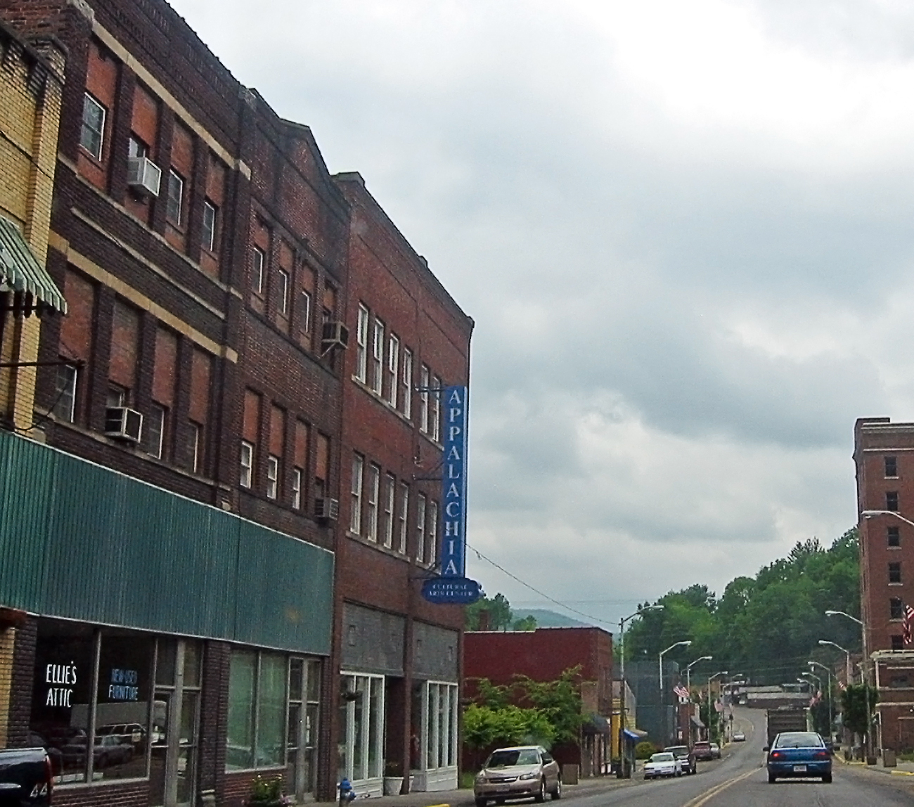
I'm going through photos from last year's trip to Appalachia, to supplement my writing up of the roadtrip tale on my blog. This is a rather poor snapshot, through the car window, of downtown Appalachia, a small town in southwestern Virginia. Since my roadtrip was to Appalachia, the region, I felt compelled to take the route to the Cumberland Gap that went through Appalachia, the town. I prefer small roads to large anyway, so I skipped the highway from Norton to Big Stone Gap, instead taking the smaller road to Appalachia, and then an even smaller road to Pennington Gap by way of Keokee. I'm still strangely pleased that there is a town called Appalachia. The region was very clearly a coal-mining area -- the only such area I saw during my trip to Appalachia (the region). Coal is important in the central and northern part of the Appalachians, and the town of Appalachia was about as far north as I got, so I saw very little coal, save in this part of Virginia. Here's a link to a map of Appalachia on MS Local Live. I hope it works. |
| Дата | |
| Чыганак | Appalachia, the town |
| Автор | pfly from Pugetopolis |
| Местоположение камеры | | Это и другие изображения по их местоположению на OpenStreetMap |
|---|
Лицензияләү
- Сез ирекле рәвештә:
- уртаклашырга – бу язмадан күчермә алырга, таратырга һәм тапшырырга
- юрамалар ясау – бу язманы үзгәртергә
- Түбәндәге шартларда:
- атрибуция – Сез тиешле бәя, лицензиягә сылтама бирергә һәм үзгәрешләр кертелгәнме-юкмы икәнен күрсәтергә тиешсез. Сез моны теләсә-нинди дөрес булган ысул белән эшли аласыз, әмма лицензиар сезне яки куллануыгызны хуплый дигән фикер калырга тиеш түгел.
- шул ук кагыйдәләр буенча таратыла – Әгәр сез бу әсәрне үзгәртәсез, әверелдерәсез яки аның нигезендә яңаны булдырасыз, башлангыч әсәрнең рөхсәтнамәсен яки башлангыч рөхсәтнамәгә туры килә торган рөхсәтнамәне кулланырга тиешсез.
| This image, originally posted to Flickr, was reviewed on December 15, 2008 by the administrator or reviewer File Upload Bot (Magnus Manske), who confirmed that it was available on Flickr under the stated license on that date. |
Файл тарихы
Файлның нинди булганлыгын күрү өчен «дата/вакыт» дигәненә басыгыз.
| Дата/вакыт | Кече рәсем | Үлчәмнәре | Кулланучы | Искәрмә | |
|---|---|---|---|---|---|
| агымдагы | 15 дек 2008, 02:56 | | 1300 × 1148 (947 Кб) | File Upload Bot (Magnus Manske) | {{Information |Description= I'm going through photos from last year's trip to Appalachia, to supplement my writing up of the roadtrip tale on [http://www.pfly.net/ my blog]. This is a rather poor snapshot, through the car window, of downtown Appalachia, |
Файлны куллану
Әлеге файл киләсе битне куллана:
Файлның гомуми кулланышы
Әлеге файл аста бирелгән викиларда куллана:
- ar.wikipedia.org проектында куллану
- azb.wikipedia.org проектында куллану
- ceb.wikipedia.org проектында куллану
- ce.wikipedia.org проектында куллану
- cy.wikipedia.org проектында куллану
- es.wikipedia.org проектында куллану
- fa.wikipedia.org проектында куллану
- ht.wikipedia.org проектында куллану
- it.wikipedia.org проектында куллану
- lld.wikipedia.org проектында куллану
- pl.wikipedia.org проектында куллану
- pt.wikipedia.org проектында куллану
- ru.wikipedia.org проектында куллану
- sh.wikipedia.org проектында куллану
- sr.wikipedia.org проектында куллану
- uk.wikipedia.org проектында куллану
- uz.wikipedia.org проектында куллану
- www.wikidata.org проектында куллану
- zh-min-nan.wikipedia.org проектында куллану