
Файл:Kanawha Ohio confluence.jpg

Алдан карауның зурлыгы: 751 × 600 нокта. Башка ачыклык: 301 × 240 нокта | 601 × 480 нокта | 962 × 768 нокта | 1280 × 1022 нокта | 1500 × 1198 нокта.
Төп файл (1500 × 1198 нокта, файл зурлыгы: 724 Кб, MIME төре: image/jpeg)
Тасвирлама
| Тасвир |
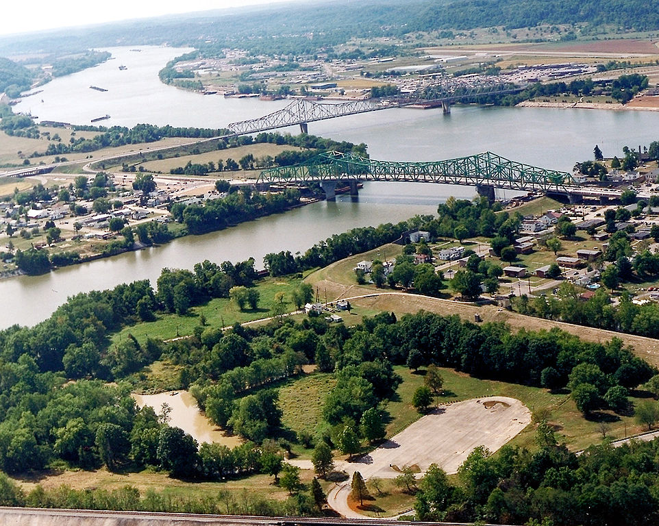
English: The confluence of the Kanawha and Ohio Rivers. The Kanawha River flows in from the left of the picture and joins the Ohio, meandering off in the distance. The town of Point Pleasant, West Virginia is in the foreground on the right. Henderson, West Virginia is on the left. The Ohio River forms the boundary between West Virginia and Ohio. The town of Gallipolis, Ohio lies in the far distance across the Ohio River. The view is to the west-southwest down the river. |
|||
| Дата | ранее 2007 | |||
| Чыганак |
U.S. Army Corps of Engineers Digital Visual Library Image page Image description page Digital Visual Library home page |
|||
| Автор | Charles Johnson, U.S. Army Corps of Engineers | |||
| Рөхсәт (Бу файлны кабат куллану) |
|
|||
| Место | Point Pleasant, West Virginia, USA |
| Местоположение камеры | | Это и другие изображения по их местоположению на OpenStreetMap |
|---|
| Annotations | This image is annotated: View the annotations at Commons |
Файл тарихы
Файлның нинди булганлыгын күрү өчен «дата/вакыт» дигәненә басыгыз.
| Дата/вакыт | Кече рәсем | Үлчәмнәре | Кулланучы | Искәрмә | |
|---|---|---|---|---|---|
| агымдагы | 23 мар 2007, 04:52 | | 1500 × 1198 (724 Кб) | DanMS | {{Information | Description = {{en|The confluence of the Kanawha and Ohio Rivers. The Kanawha River flows in from the left of the picture and joins the Ohio, meandering off in the distance. The town of Point Pleasant, West Virginia is in the foreground |
Файлны куллану
Әлеге файл киләсе битне куллана:
Файлның гомуми кулланышы
Әлеге файл аста бирелгән викиларда куллана:
- ar.wikipedia.org проектында куллану
- arz.wikipedia.org проектында куллану
- ca.wikipedia.org проектында куллану
- ceb.wikipedia.org проектында куллану
- ce.wikipedia.org проектында куллану
- cy.wikipedia.org проектында куллану
- dag.wikipedia.org проектында куллану
- de.wikipedia.org проектында куллану
- en.wikipedia.org проектында куллану
- en.wikivoyage.org проектында куллану
- es.wikipedia.org проектында куллану
- eu.wikipedia.org проектында куллану
- fa.wikipedia.org проектында куллану
- fr.wikipedia.org проектында куллану
- hu.wikipedia.org проектында куллану
- it.wikipedia.org проектында куллану
- ja.wikipedia.org проектында куллану
- ko.wikipedia.org проектында куллану
- kw.wikipedia.org проектында куллану
- lld.wikipedia.org проектында куллану
- no.wikipedia.org проектында куллану
- pl.wikipedia.org проектында куллану
- pt.wikipedia.org проектында куллану
- ro.wikipedia.org проектында куллану
- ru.wikipedia.org проектында куллану
- sh.wikipedia.org проектында куллану
- simple.wikipedia.org проектында куллану
- sr.wikipedia.org проектында куллану
Бу файлның гомуми кулланышын карау.